Knight Creek
Background
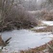
Knight Creek is situated on the north side of the Nechako River downstream from the community of Vanderhoof. Knight Creek flows through forest and agricultural lands. Much of the area along Knight Creek has been logged and/or cleared for agricultural purposes over the last century. Historical clearing practices and cattle grazing in riparian areas have contributed to stream bank stability deterioration, erosion issues, in some locations were severe, and have resulted in stream creek/relocation, erosion, and significant movement of bed materials sediment downstream. A project is being planned where Knight Creek passes under Sackner Road.
About the Knight Creek Restoration - Healthy Watershed Initiative 2021
As the stream was dry at the time of work, the stream was relocated into back into its historical banks, excess gravels washed downstream where relocated to areas where they were previously located. To mitigate continued erosion of these banks, banks were protected with a strategically placed rock spurs, and Large-woody debris (LWD) to enhance immediate protection of banks. Large-woody debris also adds habitat enhancements for juvenile and adult fish by to providing cover, and habitat diversity/complexity. Willow were also planted along intensively along banks to enhance long term bank stability, restore riparian functionality, and provide shade and cover for fish in Knight Creek.
This project was supported through the Healthy Watersheds Initiative, which is delivered by the Real Estate Foundation of BC and Watersheds BC, with financial support from the Province of British Columbia as part of its $10-billion COVID-19 response.


![]()


